

Ptolemy’s Geographia is the most extraordinary hidden in plain sight classical source document that meticulously details the geography of the Earth as it evolves through the Arabian Horizon and the Heinsohn Horizon.
The Geography, also known by its Latin names as the Geographia and the Cosmographia, is a gazetteer, an atlas, and a treatise on cartography, compiling the geographical knowledge of the 2nd-century Roman Empire.
Originally written by Ptolemy in Greek at Alexandria around AD 150, the work was a revision of a now-lost atlas by Marinus of Tyre using additional Roman and Persian gazetteers and new principles.
Its translation into Arabic in the 9th century and Latin in 1406 was highly influential on the geographical knowledge and cartographic traditions of the medieval Caliphate and Renaissance Europe.
…
Ptolemy’s text reached Italy from Constantinople in about 1400 and was translated into Latin by Jacobus Angelus of Scarperia around 1406.The first printed edition with maps, published in 1477 in Bologna, was also be the first printed book with engraved illustrations.
https://en.wikipedia.org/wiki/Geography_%28Ptolemy%29


However, the contents and attribution of Ptolemy’s Geographia are troubling.
Ever since the rediscovery of Ptolemy’s Geographia in 1295, scholars have noted that it is troublingly inconsistent both internally and with the environment in which it was supposedly compiled.
Lines, Damned Lines and Statistics: Unearthing Structure in Ptolemy’s Geographia
Leif Isaksen
6th International Workshop on Digital Approaches in Cartographic Heritage – 2011
https://leifuss.files.wordpress.com/2011/03/ica-dachisaksen.pdf
Firstly, Geographia describes a very limited “habitable world”.
Representation – Section 20
Concerning the asymmetrical nature of the geographical maps by Marinus.
…
For only by fixing the eye on the middle of the fourth part to the north of the sphere, in which the most part of the habitable world is registered, can the longitudinal lines be made to represent a semblance of straight lines, whenever it is turned around and top of each line brought down opposite on a level with the eye itself.Ptolemy’s Geographia – Translation by Louis Francis – 1994
University of Oxford Text Archive
http://ota.ox.ac.uk/desc/2422

Secondly, this “habitable world” is wedged between burning and freezing zones.
According to Ptolemy, the best recognized authority, whose geography had stood the test of thirteen hundred years, the then known world was a strip of some seventy degrees wide, mostly north of the equator, with Cadiz on the west, and farthest India or Cathay on the east, lying between the frozen and burning zones, both impassable by man.
Historical and Geographical Notes on the Earliest Discoveries in America
Henry Stevens – 1869
https://archive.org/details/historicalgeogra00stev


This is the initial red flag regarding the Ptolemy [100-170 AD] attribution because by 43 AD this world view had been updated by Pomponius Mela to reflect “five zones” [of which “two only were habitable”] and Marinus of Tyre [70–130] had already “coined the term Antarctic”.
Pomponius Mela, who wrote around AD 43, was the earliest Roman geographer. He was born in Tingentera (now Algeciras) and died c. AD 45.
His short work (De situ orbis libri III.) occupies less than one hundred pages of ordinary print, and is described by the Encyclopedia Britannica (1911) as “dry in style and deficient in method, but of pure Latinity, and occasionally relieved by pleasing word-pictures.”
…
The general views of the De situ orbis mainly agree with those current among Greek writers from Eratosthenes to Strabo; the latter was probably unknown to Mela.But Pomponius is unique among ancient geographers in that, after dividing the earth into five zones, of which two only were habitable, he asserts the existence of antichthones, inhabiting the southern temperate zone inaccessible to the folk of the northern temperate regions from the unbearable heat of the intervening torrid belt.
https://en.wikipedia.org/wiki/Pomponius_Mela
Marinus of Tyre (c. AD 70–130) was a Greek or Hellenized geographer, cartographer and mathematician, who founded mathematical geography and provided the underpinnings of Claudius Ptolemy’s influential Geography.
Marinus also coined the term Antarctic, referring to the opposite of the Arctic Circle.

Thirdly, if Ptolemy’s calculations are correct then the Earth used to be about 20 per cent smaller i.e. similar to the 20% inflation implied by the work of Marinus of Tyre.
The Geography of Ptolemy Elucidated – Thomas Glazebrook Scott – 1893
https://archive.org/details/geographyofptole00rylauoft/page/39/mode/1upHowever, references to the Antarctic date back to Marinus of Tyre [circa 70 – 130 AD] who stated the Earth’s Equatorial Circumference was “180,000 stadia” [33,300 kilometres].
Unsurprisingly, the concept of the Earth’s Girth inflating by 20% [6,775 / 33,300 = 20.34534 %] in the last 2,000 years is totally unacceptable to Settled Science.
Fourthly, Ptolemy’s enormous depository of “remarkably accurate” data has “bewildered” scholars.
Not only are we left bewildered as to how Ptolemy managed to amass such an enormous quantity of (remarkably accurate) data when no other similar document has survived, but such a huge volume of information also virtually intractable for analysis.
Lines, Damned Lines and Statistics: Unearthing Structure in Ptolemy’s Geographia
Leif Isaksen
6th International Workshop on Digital Approaches in Cartographic Heritage – 2011
https://leifuss.files.wordpress.com/2011/03/ica-dachisaksen.pdf
However, the mainstream has evidently classified these aspects of Geographia as either too troubling or too trifling because academics prefer to focus [primarily] upon “errors”.
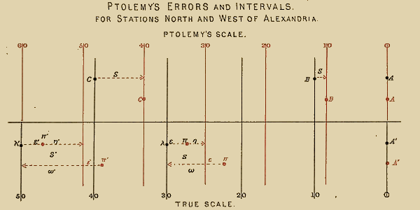
Because Ptolemy derived many of his key latitudes from crude longest day values, his latitudes are erroneous on average by roughly a degree (2 degrees for Byzantium, 4 degrees for Carthage), though capable ancient astronomers knew their latitudes to more like a minute. (Ptolemy’s own latitude was in error by 14′.)
…
It must be added that his original topographic list cannot be reconstructed: the long tables with numbers were transmitted to posterity through copies containing many scribal errors…https://en.wikipedia.org/wiki/Ptolemy#The_Geography
In Ptolemy’s later and more well-known Geography, a scribal error was made and Cattigara was located at eight and a half degrees South of the Equator.
…
This error produces an evident deformations in Ptolemy’s world map most apparent for exampled in the profile of Italy, which is markedly stretched horizontally;
…
The strange coincidence of the two aforementioned errors may be accounted for if one assumes that this identification was wrong and that at the time of Ptolemy’s sources the Fortunate Isles where actually the eastern Antilles.
The contents of Ptolemy’s Geographia indicate it was a living document which incorporated inherited knowledge from the Greek tradition.
Hipparchus of Nicaea (c. 190 – c. 120 BC) was a Greek astronomer, geographer, and mathematician.
He is considered the founder of trigonometry but is most famous for his incidental discovery of precession of the equinoxes.
…
Relatively little of Hipparchus’s direct work survives into modern times.Although he wrote at least fourteen books, only his commentary on the popular astronomical poem by Aratus was preserved by later copyists.
Most of what is known about Hipparchus comes from Strabo’s Geography and Pliny’s Natural History in the 1st century; Ptolemy‘s 2nd-century Almagest; and additional references to him in the 4th century by Pappus of Alexandria and Theon of Alexandria in their commentaries on the Almagest.
https://en.wikipedia.org/wiki/Hipparchus
Eratosthenes of Cyrene (c. 276 BC-c. 195/194 BC) was a Greek mathematician, geographer, poet, astronomer, and music theorist.
He was a man of learning, becoming the chief librarian at the Library of Alexandria.
He invented the discipline of geography, including the terminology used today.
He is best known for being the first person to calculate the circumference of the Earth, which he did by applying a measuring system using stadia, a standard unit of measure during that time period.
Ptolemy’s Geographia also incorporates knowledge contributed by successive generations of geographers and cartographers.
It seems likely that the topographical tables in books 2–7 are cumulative texts – texts which were altered and added to as new knowledge became available in the centuries after Ptolemy.
This means that information contained in different parts of the Geography is likely to be of different dates.
https://en.wikipedia.org/wiki/Ptolemy#The_Geography
Muḥammad ibn Mūsā al-Khwārizmī (c.780-c.850) was a Persian mathematician, astronomer, and geographer during the Abbasid Caliphate, a scholar in the House of Wisdom in Baghdad.
…
Al-Khwārizmī systematized and corrected Ptolemy’s data for Africa and the Middle East.Another major book was Kitab surat al-ard (“The Image of the Earth”; translated as Geography), presenting the coordinates of places based on those in the Geography of Ptolemy but with improved values for the Mediterranean Sea, Asia, and Africa.
https://en.wikipedia.org/wiki/Al-Khw%C4%81rizm%C4%AB
Al-Ṣābiʾ Thābit ibn Qurra al-Ḥarrānī (826-901) was an Sabian mathematician, physician, astronomer, and translator who lived in Baghdad in the second half of the ninth century during the time of Abbasid Caliphate.
…
He translated from Greek into Arabic works by Apollonius, Archimedes, Euclid and Ptolemy.
…
He also rewrote Hunayn’s translation of Ptolemy’s Almagest and translated Ptolemy’s Geography.https://en.wikipedia.org/wiki/Th%C4%81bit_ibn_Qurra
Al-Mas‘udi (c. 896–956) was an Arab historian and geographer.
…
In addition he was familiar with the medical work of Galen, with Ptolemaic astronomy, with the geographical work of Marinus and with the studies of Islamic geographers and astronomers.https://en.wikipedia.org/wiki/Abu_al-Hasan_’Al%C4%AB_al-Mas’%C5%ABd%C4%AB
This history of updates provides a second red flag regarding the Ptolemy [100-170 AD] attribution because the Realigned Roman Empire Time Line indicates al-Khwārizmī [780-850 CE] was updating the Geographia at roughly the same time Ptolemy was meant to be originating the Geographia.

It seems more likely, especially given the work of Pomponius Mela, that the lives of Marinus of Tyre[“little is known”] and Claudius Ptolemy [“few reliable details”] were invented [or appropriated] for the Roman Narrative after the Geographia arrived in Italy.
Beyond this, little is known of his life.
https://en.wikipedia.org/wiki/Marinus_of_Tyre
Beyond that, few reliable details of his life are known.
https://en.wikipedia.org/wiki/Ptolemy


Arguably, the original fabricators of the Ptolemy storyline explicitly acknowledged [to those in the know] the Greek heritage of the Geographia by naming Claudius Ptolemy after the Hellenistic Ptolemaic Kingdom whose capital city was Alexandria.
The Ptolemaic Kingdom was a Hellenistic kingdom based in Egypt.
It was ruled by the Ptolemaic dynasty which started with Ptolemy I Soter’s accession after the death of Alexander the Great in 323 BC and which ended with the death of Cleopatra VII and the Roman conquest in 30 BC.
…
Alexandria became the capital city and a major center of Greek culture and trade.https://en.wikipedia.org/wiki/Ptolemaic_Kingdom
Claudius Ptolemy (c. AD 100 – c. 170)[2] was a Greco-Egyptian writer, known as a mathematician, astronomer, geographer, astrologer, and poet of a single epigram in the Greek Anthology.
He lived in the city of Alexandria in the Roman province of Egypt, wrote in Koine Greek, and held Roman citizenship.
Either way, scholars are actively studying the Geographia – especially the gazetteer.
Claudii Ptolemaei Geographia
Karl Friedrich August Nobbe – 1843
https://archive.org/details/claudiiptolemaei02ptolThe Geography consists of three sections, divided among 8 books.
Book I is a treatise on cartography, describing the methods used to assemble and arrange Ptolemy’s data.
From Book II through the beginning of Book VII, a gazetteer provides longitude and latitude values for the world known to the ancient Romans (the “ecumene”).

In 2006 the University of Bern digitised the Geographia gazetteer.
The most challenging issue is the sheer scale of the catalogue, comprising some 8,000 or so locations that stretch from the Atlantic Ocean to China and from the Baltic Sea to Tanzania.
…
In effect, Ptolemy developed the first Geographical Information System.Much more significantly, it makes GIS a natural technology for investigating the catalogue.
In this endeavour we are hugely indebted to the work of the University of Bern who published the entire catalogue of locations from both the Ω and Ξ recensions as a database (Stückelberger & Graßhof 2006).
Lines, Damned Lines and Statistics: Unearthing Structure in Ptolemy’s Geographia
Leif Isaksen
6th International Workshop on Digital Approaches in Cartographic Heritage – 2011
https://leifuss.files.wordpress.com/2011/03/ica-dachisaksen.pdf


The digitised gazetteer can now be visually reconciled with the Ptolemy maps.

The digitised gazetteer highlights many interesting data points and lines of inquiry.

For example:
The digitised gazetteer confirms the Greek heritage of the Geographia because it includes the ancient Western Red Sea coastline mapped by Eratosthenes [276-194 BC].
See: https://malagabay.wordpress.com/2016/01/24/semicircular-europe-and-the-heinsohn-horizon/

The digitised gazetteer also reveals the migration of the Red Sea coastlines since 194 BC.

No wonder mainstream scholars are troubled by the Geographia.
The Geographia clearly falsifies the mainstream concept of Geologic Time [and many other approved narratives] because the Geographia documents the remarkable geological changes that have occurred [officially] since 194 BC.

However, according to the Old Japanese Cedar Tree chronology it appears likely that most of these major geological changes occurred during the 277 year period sandwiched between the Arabian Horizon [637 CE] and the Heinsohn Horizon [914 CE].

Pingback: The Arabian Horizon – The Liwa Impact | MalagaBay
Pingback: Gloger’s Rule: 4 – Turning the World on its Side | MalagaBay
Pingback: The Arabian Horizon – The Lost Lands: Dilmun | MalagaBay
Pingback: Crowd Source Science: Dutchsinse | MalagaBay
Pingback: Shaping Scotland In Two Shakes | MalagaBay
Pingback: Deranged Dating: The Big Picture | MalagaBay
Pingback: Ravenna Revisited: A Byzantine Birth | MalagaBay
Pingback: Crashing Carthage | MalagaBay
Pingback: Enigmatic Egypt: Roman Ruination – Red Sea | MalagaBay
Pingback: Late Paleocene Thermal Minimum | MalagaBay
Pingback: M for Marcus | MalagaBay
Pingback: Cape Bojador and The Fortunate Islands | MalagaBay
Pingback: Antipodal Hotspots and Bipolar Catastrophes | MalagaBay
Pingback: The Senegal Swing | MalagaBay
Pingback: Alaskan Muck: Body of Evidence | MalagaBay
Pingback: Ptolemy’s Paradigm | MalagaBay
Pingback: Climate Conundrums & History – Plasma Geology